


Images sources from Google Maps.
Week 1 4/4/2017
Lab
During the lab this week we divided the elements of the project amongst the team and brainstormed possible skyway locations. The first location was at the intersection of 33rd and Market. This skyway would connect the athletic center, library, Nesbitt Hall, and the area around the Mario statue. This skyway would be the most complex as it would connect the four locations to a central hub with benches over the intersection. The other two location both would be walkways over intersections that are frequently used by students. One would connect the end of Lancaster Walk with Lebow College of Business, while the other would connect Papadakis Integrated Sciences Building and the courtyard by the Creese Student Center.
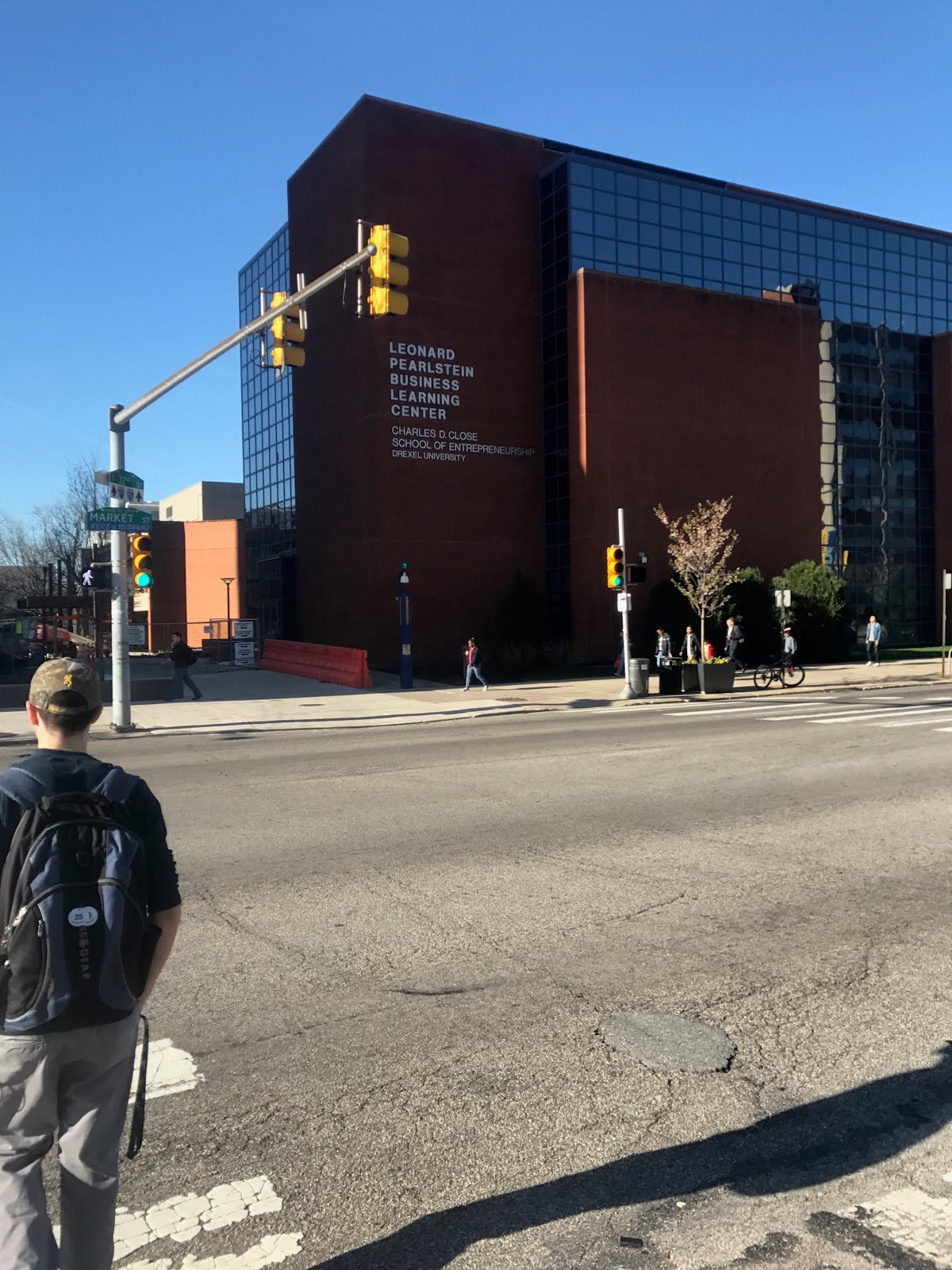

Figure 2: The intersection of 32nd and Market, one potential skyway location.
Outside of Lab
Outside of the lab, the group met up and decided upon how we will determine which of the three potential locations we would design the skywalk for, along with writing the project proposal. The method for determining which location will be used is a combination of traffic, pedestrian, and student surveys. The traffic and pedestrian surveys will determine the volume of vehicles and pedestrians moving through an intersection, along with the average wait times at the intersection for pedestrians. The student survey will be a simple survey to determine at which intersection the students would most like a skywalk.
Week 2 4/11/17
Lab
During the lab this week the student questionnaire was made to help determine where the students would most like the walkway. Additionally, a procedure was designed for the traffic volume surveys. The surveys would consist of four segments that were five minutes each. During the first five minutes, pedestrians using the intersection are counted, then vehicles for the next five minutes and repeat the each for the second time. It was designed this way because often pedestrians and vehicles are present in the crosswalks at the same time, and this allows focus on one group. While less accurate than counting both at the same time, it does make the process less complicated.
Outside of Lab
Outside of the lab this week the first of the traffic volume surveys were conducted to determine if the process worked or not. The process turned out to beast to manage and therefore will be how the group conducts the rest of the traffic volume surveys. The first two surveys were conducted at 32nd & Market and 33rd & Chestnut. The number of people using the intersection fluctuates with when classes start and end. The number of people using the intersection between 2:50 and 2:55 is most likely much larger because classes are getting out around that time and students are also going to the classes that start at 3:00.
Table 1: Results of the first two traffic volume surveys.

Week 3 4/18/17
Lab
This week during the lab group four went to the possible locations for the walkway to complete the traffic volume surveys. The intersection of Market & 33rd was the busiest, with almost 200 vehicles and 200 pedestrians crossing it during the five-minute intervals. This is the intersection that the group initially believed would be the busiest and was the one we were planning on designing a walkway for. While the group's decision is not final yet it is very likely that this will be the location for the walkway. The design would consist of two walkways that meet over the middle of the intersection to form an X shape with a circular platform in the middle.
Week 4 4/25/17
 |
| Figure 3: Preliminary sketch of the ramp to get to the walkway from the end near the Mario statue |
 |
| Figure 4: Sketch of the intersection and the walkway. |
This week we looked at the traffic survey data to determine which intersection the walkway would be designed for. After comparing the volume of pedestrians and vehicles across all of the intersections the intersection of 33rd & Market was chosen as the location for the walkway. Above are two preliminary sketches, one of the actual walkway and one of the wheelchair friendly ramps for the walkway. By the beginning of the lab during week six we hope to have a rough 3d Model of the intersections including the buildings around the intersection so that we can start modeling the walkway itself. The plan is to have the walkway connect to the three buildings shown on figure 4 while ending in a ramp on the southeast corner of the intersection. The main platform of the walkway would be directly above the intersection.
Week 5 5/2/17
Lab
This week during the lab we continued to work on the digital model of the walkway. We intend to have the model finished in the next couple of weeks and then 3D print the model. Other than that we began the final report draft that is due week 7. Most of the work this week was done on the 3D model and the final report. A K'Nex model of the walkway was finished this week. The blog also was updated and edited for ease of navigation. The FAQ section on the blog was updated with new information about the location and design of the skyway.

Week 6 5/9/17
This week during the lab the layout of the main platform created to display what features will be present on the central platform of the walkway. These features are there so that the central hub can be utilized as a meeting place during good weather. Not shown are the ends of the walkways that connect to the buildings. Also, the choice to not design the walkway as covered was to save costs, because a covered structure would be much more costly. Going forward the 3D CAD model needs to be completed, and a handcrafted physical model will be created.
Week 5 5/2/17
Lab
This week during the lab we continued to work on the digital model of the walkway. We intend to have the model finished in the next couple of weeks and then 3D print the model. Other than that we began the final report draft that is due week 7. Most of the work this week was done on the 3D model and the final report. A K'Nex model of the walkway was finished this week. The blog also was updated and edited for ease of navigation. The FAQ section on the blog was updated with new information about the location and design of the skyway.

Figure 5: Labeled K'Nex model of proposed skyway.
Week 6 5/9/17
 |
| Figure 6: Outline of the main platform over the roads |
 |
| Figure 7: Design of the main platform featuring tables, benches, and a central flower bed. |
This week the draft of the final report was finished and presented to the adviser for the class. The team received great feedback from the professor and began working on the final draft of the report. Work was continued on the CAD model, but it proved to be extremely time consuming and will take a bit longer than expected to complete.
Along with the CAD model, more detailed plans for the physical model were also started and were hand drawn. Construction of the physical model will begin during week 8. The model will be constructed to scale and will be made primarily of cardboard. With the project approaching the final stages, there has not been as much progress to report as progress has been coming in smaller increments. The scale of the model will be 4 ft/cm. During week 8 work will continue on the final draft of the project report as well as the final presentation.
Week 8 & 9 5/23/2017 - 5/30/2017
These past two weeks the CAD model has made serious advances. The center hub was finished with benches and a green space in the center. As seen in Figure 9, the railings were worked on and are currently nearly complete. The stairs and ramp leading down to the Mario Statue have also been designed and only requires a few extra finishing touches. Along with the CAD model, the presentation and final project have made progress as well. Since the project is in its final stages, there has not been as much eventful progress to report.
 |
| Figure 8: Caded Design of the bridge with surrounding buildings. |
 |
| Figure 9: Caded Design of the center hub with benches, railings and green space. |
No comments:
Post a Comment